|
Changeable weather conditions set to dominate
Rain, sleet and snow at times, snow primarily in the north
For the weather for the next few days click here
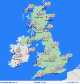
Sunday 11/2/18
A cold and showery day is expected across many areas of the UK into Sunday with the showers most frequent across Scotland, Ireland, N England and Wales where they will be wintry on high ground along with some snow accumulations in places too. Showers fewer further south and east and here there will be some drier and brighter intervals. Cold-feeling day for all given a fresh or strong W or NW'ly wind. Highs 2C to 6C.
 Monday 12/2/18 Monday 12/2/18
A likely cold, frosty and perhaps icy start to next week is currently expected along with further wintry showers. The showers still most frequent across northern and western areas where additional snowfall is expected, especially on higher ground where some accumulations are possible. Showers fewer still further south and east where it will be drier and brighter. Fresh or still strong W or NW'ly wind with a noticeable wind-chill factor. Highs 2C to 6C
 Tuesday 13/2/18 Tuesday 13/2/18
A chilly start with possile frost and icy patches in places, perhaps especially across England and Wales, but becoming increasingly unsettled through the day as low pressure arrives from the west to bring increasingly wet and windy conditions across northern and western areas in particular, gales possible across Scotland and Ireland. Driest and brightest for longest across south-east England. Still chilly but less-cold than previous days. Highs 3C to 8C.
 Wednesday 14/2/18 Wednesday 14/2/18
Uncertainties but a likely wet and windy start for many areas with rain, sleet and perhaps hill snow moving south and east, this soon clearing. Following may well be a return to a colder and showery west or north-westerly wind, the showers most frequent in the north and west and wintry again, especially on higher ground. Remaining windy for all. Highs 3C to 7C.
Thursday 15/2/18
Still remaining unsettled as low pressure likely dominates to the north-west to maintain a risk of showery conditions and perhaps with some longer spells of rain in the north and west. Wintry precipitation still seems possible, especially on higher ground in the north and it will also likely remain very windy too with strong or near gale force winds in the north and west. Highs 3C to 7C.
Friday 16/2/18
Low confidence but showery weather likely continuing, again wintry on northern hills before then perhaps drier later in the day from the west and south-west with overnight frost and icy conditions developing. Remaining windy in the north and west, winds ligher further south and east. Highs 2C to 6C.
|
