|
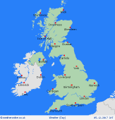
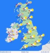
High pressure is set to dominate bringing a more protracted settled spell with below average rainfall totals but, overall, rather cool temperatures.
For the weather for the next few days click here
Wednesday 16/5/18
Into next Wednesday and cofidence is increasing for high pressure to build into the UK from the west through the day introducing mainly fine and settled conditions. A few showers can't be ruled out across more southern and eastern areas of England where a cool NE'ly breeze is forecast too, winds light elsewhere. Best of the sunshine in the north and west, but cool and with rather a rather chilly night ahead. Highs around, 9C to 14C.
 Thursday 17/5/18 Thursday 17/5/18
During Thursday and high pressure is now forecast to be situated over most of the British Isles. As a result after a chilly start, perhaps with ground frost, much of the day for many areas will be dry with bright or sunny spells, perhaps prolonged in places. Winds light and variable for most areas, but perhaps still light or moderate N or NE'ly in the south and east. Temperatures still rather cool and near or slightly below average, highs 9C to 14C at best.
 Friday 18/5/18 Friday 18/5/18
At the moment Friday is set to maintain fine and settled conditions now as high pressure persists and keeps Atlantic low pressure systems to the west of the British Isles. Some uncertainties over the details but most areas remaining dry after another chilly start with bright or sunny spells developing. Winds light and rather variable for most areas. Temperatures still rather cool, highs 10C to 15C.
 Saturday 19/5/18 Saturday 19/5/18
Into Saturday and, for now, it does look as though high pressure will maintain further dry and settled conditions across many areas. Bright or sunny spells are again forecast through the day, perhaps prolonged in places despite some variable cloud. Winds still light and variable for most regions, but perhaps becoming SW'ly light or moderate in the north and west. A little warmer than previous days with near average temperatures. Highs 12C to 17C.
Sunday 20/5/18
At the moment no major changes are forecast by next Sunday with high pressure sitll the dominant feature. There may be an increased risk of a few showers developing across far southern areas of England, while some patchy rain or showers may move into north-west Scotland. Otherwise, for many areas, it remains dry with bright or sunny spells. Winds perhaps E or ENE'ly light or moderate in the south, more SW'ly moderate in the north and west. Highs 12C to 17C.
Monday 21/5/18
Uncertainties by the following Monday but it may well still be predominantl settled as high pressure persists either over or just to the north-east. Perhaps more of an E'ly breeze developing by this point and this lowering temperatures across areas near to the N Sea, otherwise still pleasantly warm, especially in the west and in any sunny spells. Temperatures near average, highs 12C to 17C.
|


